Science
Haunting photo of Earth and moon snapped by China's experimental lunar satellites
A pair of small experimental satellites have begun tests related to future lunar communication and navigation services for China's moon ambitions.
The Tiandu-1 and Tiandu-2 satellites launched toward the moon along with the Queqiao-2 lunar communications relay satellite on a Long March 8 rocket on March 19. The latter spacecraft will support a major mission — the upcoming Chang'e 6 lunar far side sample return effort, which could launch as soon as next month —but the former are intended as a pathfinder for future lunar infrastructure.
China's Deep Space Exploration Lab (DSEL) stated on April 13 that Tiandu-1 and Tiandu-2 had carried out tests of high-reliability transmission and routing between Earth and the lunar surface.
One of the pair also transmitted an infrared image showing the heavily cratered far side of the moon, including a view of a distant planet Earth.
Related: 'Everything has changed since Apollo': Why landing on the moon is still incredibly difficult in 2024
The Tiandu pair entered lunar orbit on April 3 and are flying in formation around 124 miles (200 kilometers) apart. Tiandu-1 weighs 134 pounds (61 kilograms) and is equipped with a Ka-band dual-frequency communicator, a laser retroreflector and a space router. Tiandu-2 weighs 33 lbs (15 kg) and carries communication and navigation devices.
—Packs of dog-shaped robots could one day roam the moon — if they can find their footing on Earth first
—April's full 'Pink Moon' blooms amid a meteor shower tomorrow. Here's how to get the best view.
—What happened when the moon 'turned itself inside out' billions of years ago?
DSEL stated that the test satellites will conduct further lunar communication and navigation Technology experiments. The results will guide the design and construction of the planned International Lunar Research Station (ILRS) and a Queqiao satellite constellation for lunar communication, navigation and remote sensing.


Chris Paul vs John Stockton: Who Mastered the Art of the Assist?

Los Angeles Lakers To Make Big Trade Within 72 Hours?


Ohio State Cheerleader’s Photos Go Viral After Indiana Game

Rust' finally set to premiere | The Express Tribune


Will Myles Garrett play for the Browns against the Steelers in Week 12?

Where to watch Steelers vs Browns on TV, stream online | Thursday Night Football


-

 Science4d ago
Inside Capitol Hill’s Latest UFO Hearings
-

 Science4d ago
You Won’t Want to Miss the Leonid Meteor Shower. Here’s How and When You Can See It
-
 Science4d ago
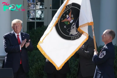
Here’s What Trump’s Win Means for NASA
-

 Science1w ago
Why Risky Wildfire Zones Have Been Increasing Around the World
-

 Science1w ago
It’s Time to Redefine What a Megafire Is in the Climate Change Era
-

 Science1w ago
4 Astronauts Return to Earth After Being Delayed by Boeing’s Capsule Trouble and Hurricane Milton
-
 Science1w ago
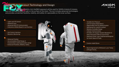
The Elegance and Awkwardness of NASA’s New Moon Suit, Designed by Axiom and Prada
-
 Science2w ago
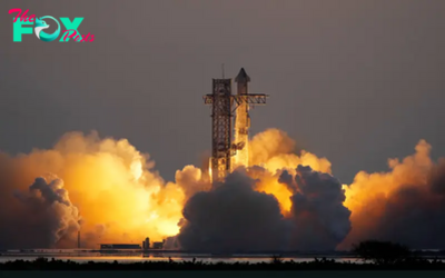
SpaceX Launches Its Mega Starship Rocket. This Time, Mechanical Arms Catch It at Landing