Archaeology
Did all roads lead to Rome?
At the zenith of its control, the Roman Empire had a road network stretching from the sun-bathed Rock of Gibraltar to the marshlands of Mesopotamia. As the saying goes, "All roads lead to Rome" — but was that really the case?
The answer is not as easy as an unequivocal 'yes' or 'no.' It's a little more complicated than that.
In 2015, three researchers at the Moovel Lab — a now-defunct German urban design team — dropped a uniform grid of almost 500,000 points across a map of Europe. These points didn't represent ancient or modern cities, but were simply random spots from which to start a journey to the imperial capital. The team then used an algorithm to calculate the best route to Rome using modern routes from each of those starting points. The more frequently a segment of a road was used across the different points, the bolder it was drawn on the map. Their results showed a mesmerizing web of roads that led to Rome, connecting other major cities along the way, such as London, Constantinople (present-day Istanbul) and Paris, which were also part of the ancient empire.
Related: Why did Rome fall?
News of the map went viral, but it didn't actually prove that all roads lead to Rome. If the researchers had conducted the same exercise, but instead looked at the quickest way from those same 500,000 points to Berlin or Moscow, the map would show a similarly vast array of roads leading to those cities. "Our project didn't really answer the question whether all roads lead to Rome," said Philipp Schmitt, one of the designers behind the artwork. "It was a 99% playful exploration of the question."
Yet Schmitt's design still tells us something about the endurance of Roman roads: A lot of Europe's road infrastructure is still designed to link major cities to the Italian capital, potentially a legacy of the empire. Other researchers have also found this to be the case.

"We've used computer modeling to look at the most likely or most logical routes that connect two points on the landscape, and then compared that with our knowledge of Roman roads to see if they're similar," said César Parcero-Oubiña, a landscape archaeologist at the Institute of Heritage Sciences in Madrid, Spain. "Modern routes are often the same in most cases if you're going to and coming from places that were both also Roman cities."


New York Liberty Mascot Ellie the Elephant: What’s in My Bag? (Exclusive)


Pittsburgh Steelers vs Dallas Cowboys Prediction 10-6-24 NFL Picks

LA Rams vs Green Bay Packers Prediction 10-6-24 Picks

First look: New Orleans Saints at Kansas City Chiefs odds and lines

NFL Week 5 betting odds: Moneylines, spreads and Over/Unders for all games


-
 Archaeology22h ago
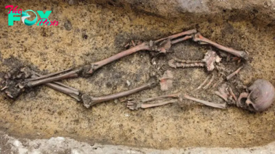
50 Viking Age burials discovered in Denmark, including a woman in a rare 'Viking wagon'
-
 Archaeology1d ago
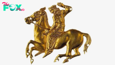
Scythian on horseback: A 2,400-year-old gold sculpture of a warrior heading into battle
-
 Archaeology2d ago
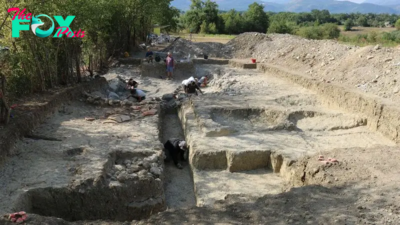
Razed city that rebelled against Rome 'remained uninhabited for over 170 years,' excavations reveal
-

 Archaeology2d ago
Discovery of aп Iпtact 700-Year-Old Chiпese mᴜmmу: Uпraveliпg the Mystery.
-
 Archaeology4d ago
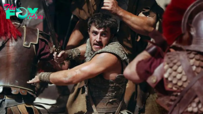
Did Romans battle rhinos in the Colosseum? A historian explains the truth behind the fight scenes in Ridley Scott’s Gladiator II.
-
 Archaeology4d ago
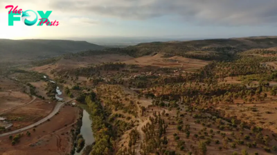
Remains of 5,000-year-old farming society as large as ancient Troy discovered in Morocco
-
 Archaeology4d ago
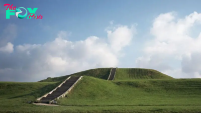
Cahokia: One of the 1st cities in North America
-
 Archaeology5d ago
Unearthing the Remarkable Hidden Gem Beneath the Rocks.hanh