Science
East Coast cities are sinking at a shocking rate, NASA images show
NASA satellite images show the shocking speed at which the land is sinking beneath major U.S. cities, including Baltimore, New York and Charleston.
The images, revealed by NASA Earth Observatory on Feb. 20, show land movement across the East Coast, with areas in dark blue sinking at the fastest rate. The subsidence threatens infrastructure, farmland and wetlands — especially as sea levels rise.
Between 2007 and 2020, the ground underneath New York, Baltimore and Norfolk, Virginia, sank by an average of 0.04 and 0.08 inch (1 to 2 millimeters) a year, the satellite data showed. In several counties in Delaware, Maryland, South Carolina and Georgia sank at double or triple that rate, according to a study published Jan. 2 in the journal PNAS Nexus.
"Subsidence is a pernicious, highly localized, and often overlooked problem in comparison to global sea level rise, but it's a major factor that explains why water levels are rising in many parts of the eastern U.S.," Leonard Ohenhen, a geophysicist at Virginia Tech and one of the authors of the study, told NASA Earth Observatory.
Related: New York City may be sinking under its own weight because the buildings are too heavy, scientists warn
Subsidence has many consequences for people living along the coast, including a greater risk of flooding and damage to homes and infrastructure caused by unstable ground. At least 867,000 properties and critical infrastructure — including highways, railways, airports, dams and levees — were all subsiding, according to the study.
Sinking land can also lead to salt water intruding into farmland, crops and fresh water supplies, as well as impacting wildlife habitats like marshlands, according to NASA Earth Observatory.
One of the fastest-sinking cities is Charleston, South Carolina, where the downtown area is just 10 feet (3 meters) above sea level. The city is sinking by around 0.16 inch (4 mm) per year.

According to NASA Earth Observatory, the subsidence under Charleston is largely caused by human activity such as groundwater pumping. When humans drain underground aquifers or extract natural gas from the ground, the empty spaces left behind can collapse, causing the land above to sink. However, in places like New York, a combination of factors are contributing to subsidence, including the soft land it is built on and the weight of the buildings.
The researchers used satellite images and ground-based GPS sensors to study the coast from New England to Florida. They then created a map that revealed the variability in the rising and falling of various areas along the coast. That data was measured against data collected by the ground-based Global Navigation Satellite System to detect the rate of sinking.
—A major US city is sinking, and this time it's due to 'underground climate change'
—Climate change causes a mountain peak frozen for thousands of years to collapse
—Satellite images reveal just how much cities on the US East Coast are sinking
According to the maps, the mid-Atlantic region is sinking more than the northeastern U.S. This is largely down to a geological process called glacial isostatic adjustment, which is the ongoing movement of land once burdened by heavy ice sheets during the last ice age, which lasted from around 126,000 to 11,700 years ago.
The edge of the huge Laurentide ice sheet ran through what are now Pennsylvania and New Jersey, pushing the land down with the weight of the ice. Meanwhile, the land beyond the ice's perimeter was forced upwards. When the ice began to melt around 12,000 years ago, the land that once bulged along the coast began to sink and is continuing to do so.
Study co-author Manoochehr Shirzaei, director of the Virginia Tech lab, said the researchers hope to map the Gulf Coast next. "Our long-range goal is to map all of the world's coastlines using this technique," he said in the press release. "We know that planners in several U.S. cities are already using our data to make our coastlines more resilient, and we want cities all over the world to be able to do the same."


Trump Media’s Accounting Firm Charged With Massive Fraud


Why do dogs sniff each other's butts?

Gut bacteria sometimes get people drunk, leading to DUIs and liver disease


-

 Science1d ago
China launches Chang'e 6 sample-return mission to moon's far side
-

 Science1d ago
We Still Don’t Fully Understand Time
-

 Science1d ago
James Webb telescope spots wind blowing faster than a bullet on '2-faced planet' with eternal night
-
 Science1d ago
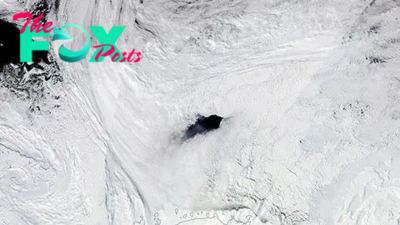
Antarctic ice hole the size of Switzerland keeps cracking open. Now scientists finally know why.
-
 Science1d ago
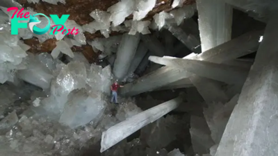
Cave of Crystals: The deadly cavern in Mexico dubbed 'the Sistine Chapel of crystals'
-
 Science1d ago
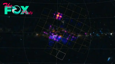
China's 'lobster eye' Einstein telescope releases 1st batch of trippy space images
-
 Science1d ago
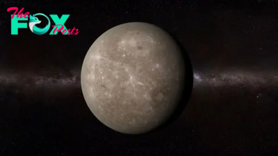
It's the best time of year to spot Mercury. Here's how to find it.
-

 Science2d ago
No, the James Webb Space Telescope probably didn't detect signs of alien life — but it soon could